
Gps For Precision Farming: How Satellite Guidance Transforms Modern Fields
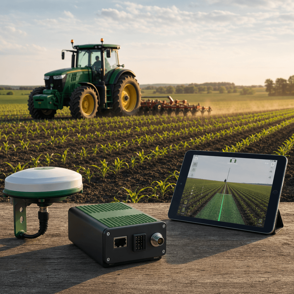
A tractor tracing dead-straight rows across a field, hour after hour, with no wandering, no double-passes, and no skipped strips is the plainest picture of what modern satellite guidance delivers. That precision is what turns fuel, seed, fertilizer, and operator hours into measurable savings. When people talk about gps for precision farming, this is the payoff they mean: an antenna on the roof, correction data feeding the receiver, and a screen in the cab keeping the machine on a repeatable line down to a couple of centimeters. Agro Navigator sits exactly at that intersection, pairing RTK GPS autosteer hardware with a native iOS app so the iPad or iPhone you already run in the cab becomes the guidance display, no Windows laptop required.
The promise is not abstract. Independent field studies place net gains from precision GPS in the range of a few dollars per acre, with input savings and overlap reductions that show up in the first season. The trick is understanding what the technology actually does, what accuracy your operations demand, and how an open, iOS-first system like Agro Navigator delivers that without locking you into a proprietary terminal.
Table of contents
- What GPS for precision farming really means today
- From straight lines to smart fields: the practical payoff
- Inside Agro Navigator: RTK autosteer built for iPad and iPhone
- Wired or 4G-enabled: choosing your Agro Navigator setup
- Putting guidance to work: the Agro Navigator process
- Frequently asked questions
What GPS for precision farming really means today
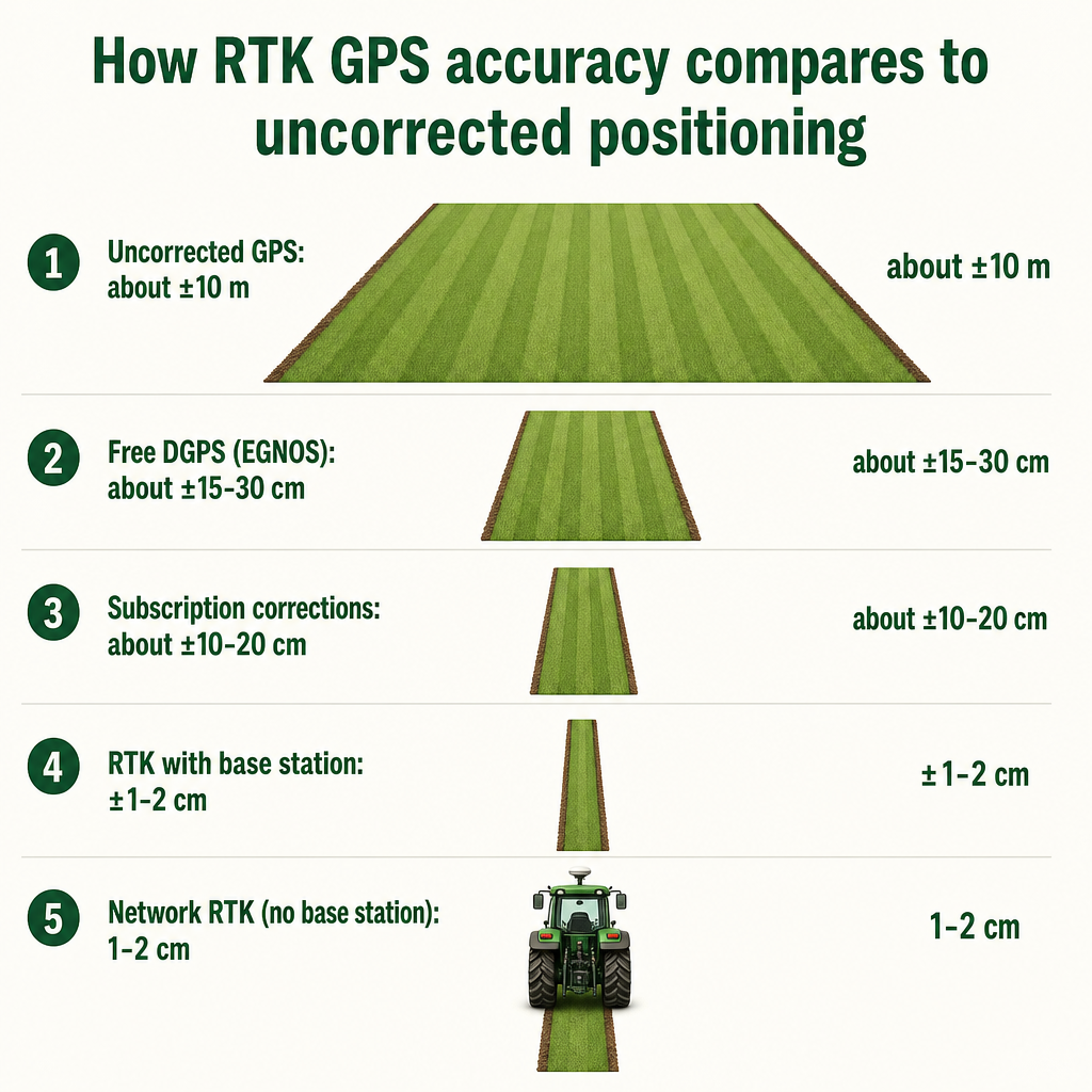
The phrase covers far more than a receiver bolted to the cab roof. Modern agricultural guidance draws on multiple satellite constellations at once, using GPS alongside GLONASS, Galileo, and BeiDou to fix a machine's position, and then layers a correction service on top to sharpen that fix to field-work tolerances. Without any correction, raw satellite positioning drifts by roughly ten meters, which is useless for planting a straight row. Correction is what closes the gap.
The accuracy ladder is worth understanding because it decides which jobs a system can do. Free differential correction such as EGNOS brings accuracy down to about 15 to 30 centimeters. Subscription correction services land in the 10 to 20 centimeter range. Real-Time Kinematic correction, or RTK, is the step that changes everything: with a base station or a network reference, RTK delivers accuracy of roughly one to two centimeters, and network RTK can reach that same one-to-two-centimeter band without you owning a base station at all, drawing corrections from a reference network instead.
Why do centimeters matter? Because the value of guidance compounds with precision. At sub-meter accuracy you can log where equipment has been, which is enough for basic fleet tracking. But planting, strip-till, controlled-traffic farming, and in-row cultivation all demand RTK-grade accuracy, because a few centimeters of drift multiplied across every pass means seed placed off-row, inputs doubled or missed, and traffic lanes that wander into the crop. This is the accuracy bracket Agro Navigator is built for, since the system is designed to work with RTK GNSS receivers and AgOpenGPS-style autosteer control.
Guidance itself takes several forms once the position is accurate enough to trust. Straight AB-line guidance is the foundation, but contour following and adaptive curve modes handle irregular field shapes, and ISOBUS-compatible control lets the same positioning data drive smart implements rather than just steering the tractor. The common thread is that a precise, repeatable position becomes the reference for planting, spraying, fertilizing, and harvesting alike.
From straight lines to smart fields: the practical payoff
The economics of precision GPS are documented well enough to set realistic expectations. Industry summaries of multiple studies report net benefits in the range of roughly three to twelve dollars per acre, input cost savings of up to twenty percent, and average yield increases near fifteen percent. GPS-guided and autonomous machinery has been shown to cut field overlap by as much as ninety percent, and many commercial farms report reaching full return on investment within the first planting and harvest season.
Those numbers are industry-wide averages, not promises specific to any one farm, and they belong in your planning as benchmarks rather than guarantees. Your actual return depends on field size, crop, input prices, and how many machines you convert. But the mechanisms behind the savings are straightforward. Overlap reduction is the most immediate: when every pass butts cleanly against the last instead of overlapping by a foot on each side, you spray less chemical, spread less fertilizer, burn less fuel, and cover more ground per hour. Reduce overlap and you have simultaneously cut input cost, lowered fuel use, and reduced the environmental load of over-application.
Precision guidance maximizes output while reducing input, and the same discipline that saves fuel also curbs the over-application of fertilizers and agrochemicals.
That sustainability angle is not a soft benefit. When guidance keeps inputs on target, less nitrogen leaches, fewer chemicals move off-field, and the operation's footprint shrinks alongside its cost base. Add repeatable guidance lines across seasons and controlled-traffic patterns become practical, protecting soil structure in the zones where machines actually run.
Beyond steering, the same positioning backbone supports field mapping for records and insurance, yield mapping when paired with a yield monitor, and variable-rate application of seed, lime, and fertilizer when coupled with a rate controller. Equipment guidance, route planning, crop monitoring, maintenance scheduling, and asset protection all draw on the same GPS foundation. The point is that a guidance investment is rarely just about driving straight; it becomes the data spine of a more measurable operation. If you are already thinking about how implements fit into this picture, our overview of essential tractor attachments for precision farming shows how guidance and smart implements reinforce each other.
Inside Agro Navigator: RTK autosteer built for iPad and iPhone
Agro Navigator is a precision agriculture technology company built around a specific idea: deliver RTK GPS autosteer through hardware you install once and a native iOS app that runs on the iPad or iPhone already in your cab. The system is built on the open-source AgOpenGPS platform, which means it belongs to the open, -flexible side of the guidance market rather than the closed-terminal world. That openness is deliberate, and it shapes almost every design choice.
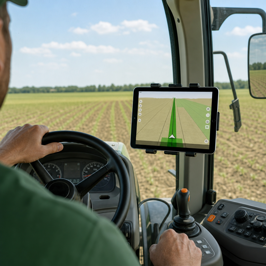
The headline difference is the display. Most AgOpenGPS builds, and many aftermarket guidance setups, depend on a Windows laptop bolted somewhere in the cab, with the reliability headaches, power issues, USB hubs, and clutter that come with it. Agro Navigator replaces that laptop with a dedicated native iOS app for iPad and iPhone, positioning it as the first AgOpenGPS-compatible system built specifically for a native iOS experience. If an operator already uses an iPad for records and communication, guidance now lives on the same familiar device, updates arrive through the App Store, and the cab loses a fragile computer. The deeper technical case for this shift is laid out in our guide to RTK GPS autosteer for iPad without a Windows PC.
Underneath the app sits dedicated autosteer control hardware. The system integrates with a tractor's CAN bus, which matters because it targets steer-ready tractors directly. Many modern machines already ship with integrated steering valves and CAN bus wiring, but the manufacturer keeps autosteer locked behind a proprietary terminal you have to buy separately. By interfacing over CAN bus, Agro Navigator gives owners of steer-ready tractors a path to autosteer that does not require add-on wheel motors and does not require the OEM terminal.
Compatibility is the other pillar. The system is fully compatible with existing community AgOpenGPS boards and RTK GPS receivers. For a farmer or dealer who already invested in a GNSS receiver and control boards, that means the past investment carries forward: Agro Navigator becomes the iOS front-end and autosteer controller sitting on top of hardware you already own. For dealers and resellers, it slots into mixed hardware stacks as an open platform they can integrate and support rather than a locked ecosystem they cannot touch.
The roadmap points where the wider industry is heading. Planned capabilities include predefined path driving, which is the semi-autonomous execution of pre-planned field routes, and multi-vehicle coordination, where several machines work the same field along coordinated paths. Those features track the broader move from simple steering toward supervised autonomy and coordinated fleets. They are planned direction, not shipping guarantees, and the current value stands on its own: RTK-grade autosteer, native iOS control, CAN bus integration for steer-ready tractors, and openness that protects existing hardware.
Wired or 4G-enabled: choosing your Agro Navigator setup
Agro Navigator ships in two hardware configurations, and choosing between them comes down to how many machines you run and whether you need to see them remotely. Fleet and guidance buyers are generally advised to weigh asset type, property size and field count, cellular coverage, power source, reporting needs, and required accuracy. Both Agro Navigator configurations share the same RTK-grade accuracy foundation and the same iOS app, so the decision is really about connectivity and fleet visibility.
The base wired autosteer model connects to the iPad or iPhone via Ethernet over USB and provides the dedicated autosteer control hardware and CAN bus integration for steer-ready tractors. It is the direct, self-contained choice.
The advanced 4G/GSM model includes everything in the base unit and adds a built-in 4G/GSM modem. That modem unlocks live telemetry from the machine, remote monitoring of location and status, and fleet management through an online dashboard that gives multi-vehicle visibility.
| Consideration | Base wired model | Advanced 4G/GSM model |
|---|---|---|
| Connection to device | Ethernet over USB | Ethernet over USB plus built-in 4G/GSM modem |
| Autosteer control | Dedicated hardware | Dedicated hardware |
| Steer-ready CAN bus integration | Yes | Yes |
| Live telemetry and remote monitoring | No | Yes, via built-in modem |
| Online fleet dashboard | No | Yes, multi-vehicle visibility |
| Best fit | Single machine, single operator | Multiple machines, remote oversight, dealer support |
The practical rule is simple. If you run a single machine with a single operator and have no need to watch equipment from an office or phone, the base wired unit delivers full RTK autosteer without paying for connectivity you will not use. If you run multiple machines, want real-time location and status, need utilization and work data across a fleet, or rely on a dealer who supports you remotely, the advanced 4G unit earns its place. Cellular coverage across your fields is worth confirming before committing to telemetry, since the modem depends on it.
The telemetry and dashboard features are described here at a high level on purpose. Specific dashboard functions such as alert types, geofencing rules, reporting formats, and data retention are best confirmed with current Agro Navigator documentation, since exact capabilities vary as the platform develops.
Agro Navigator
See how RTK autosteer runs on your iPad, no Windows PC needed
Go deeper on the iOS-first guidance stack that replaces the cab laptop and works with steer-ready tractors and existing AgOpenGPS hardware.
Read the iPad autosteer guidePutting guidance to work: the Agro Navigator process
Moving to satellite guidance follows a recognizable path, and it works best when Agro Navigator and its dealers guide the buyer through it rather than leaving a farmer to assemble it alone. Best-practice guidance from the wider industry emphasizes accurate field boundary mapping, operator training, disciplined data management, and regular maintenance, and each of those maps onto a concrete step.
The first step is assessing needs: the accuracy your operations demand, the number of tractors involved, the availability of an RTK signal across your area, and cellular coverage if telemetry matters. Planting and cultivation push you toward RTK-grade accuracy, while lighter tracking tasks may not.
Second comes a compatibility check. Confirm your tractors are genuinely steer-ready with integrated steering and CAN bus, and list any RTK receivers and AgOpenGPS boards you already own, since Agro Navigator's compatibility with community boards and RTK receivers lets that hardware carry forward.
Third is selecting the configuration, using the wired-versus-4G logic above: base wired for a single machine, advanced 4G where multiple machines, remote monitoring, or dealer support come into play.
Fourth, plan RTK corrections. Public or network RTK is often available and can supply one-to-two-centimeter accuracy without your own base station, and the supported correction types are worth confirming with Agro Navigator sales rather than assumed.
Fifth is installation and calibration: mounting the GNSS antenna and autosteer hardware, connecting the CAN bus on steer-ready tractors, running steering calibrations, and setting up initial AB lines and field boundaries. Accurate boundary mapping at this stage pays off across every later season.
Sixth, train operators, with the focus on the iPad and iPhone app workflows, the guidance modes, and safety. This is the point to make the safety boundary explicit: Agro Navigator is a driver-assistance and autosteer system, not permission to leave the cab. Industry norms require operators to remain in the cab, ready to take control at any moment, and to know how to disengage the system immediately.
Seventh and finally, monitor results and data. Yield maps, overlap reductions, and input-usage records are how you validate the return on investment against those industry benchmarks, and how you refine guidance lines and input plans season over season. Where fields sit on complex topography, guidance planning changes character, a theme our look at terrace farming examples around the world explores in more depth.
One note on the legal side: rules for on-farm autosteer and supervised autonomy vary by jurisdiction, and stricter requirements typically apply only to unattended autonomous vehicles or public-road use. Because those rules are location-specific, confirm the current requirements for semi-autonomous machinery with your local regulator before relying on any autonomy feature.
Frequently asked questions
Will Agro Navigator work with my existing RTK receiver and AgOpenGPS boards?
Yes. The system is stated to be fully compatible with existing community AgOpenGPS boards and RTK GPS receivers. That means an existing GNSS or RTK receiver and control boards can be reused, with Agro Navigator acting as the iOS front-end and autosteer controller on top of that hardware. Confirm your specific receiver and board models and accepted RTK correction formats with Agro Navigator sales before purchase, since exact supported formats are best verified against current documentation.
Do I really not need a Windows PC in the cab?
Correct. The core difference from a typical AgOpenGPS build is that Agro Navigator runs on a native iOS app for iPad and iPhone rather than a Windows laptop. Guidance and autosteer control happen through the app on the device you likely already use in the cab, which removes the laptop, its cables, and its power and reliability problems. Updates come through the App Store.
What accuracy can I expect, and is it enough for planting?
Agro Navigator is designed to work with RTK GNSS receivers, which places it in the high-accuracy bracket. RTK correction delivers roughly one to two centimeters of accuracy, whether from your own base station or a network RTK service. That level is what planting, strip-till, controlled-traffic farming, and in-row work require, so RTK-grade guidance is suited to those precision tasks rather than only rough tracking.
Which configuration should I choose, wired or 4G?
Choose the base wired model if you run a single machine with a single operator and do not need remote visibility. Choose the advanced 4G/GSM model if you operate multiple machines, want live telemetry and remote monitoring, need fleet visibility through the online dashboard, or rely on remote dealer support. Both share the same autosteer hardware and iOS app; the difference is the built-in 4G/GSM modem and the online dashboard it enables. Check cellular coverage across your fields before committing to telemetry.
Can I leave the cab once autosteer is engaged?
No. Agro Navigator is a driver-assistance and autosteer system, not full autonomy. Industry safety norms require the operator to stay in the cab, ready to take control at any time, and trained to disengage the system in an emergency. Planned roadmap features such as predefined path driving and multi-vehicle coordination are supervised capabilities, and any autonomy feature should be used within your local regulations for semi-autonomous machinery.
How quickly does precision GPS pay for itself?
Industry summaries report net benefits of roughly three to twelve dollars per acre, input savings up to twenty percent, yield increases near fifteen percent, and overlap reductions up to ninety percent, with many farms reaching full return within the first planting and harvest season. These are industry-wide averages, not Agro Navigator-specific promises. Your actual return depends on field size, crops, input prices, and how many machines you convert, and it is best validated with your own yield and input data.
The next move is to match your fields and fleet to the right configuration. Map how many tractors are steer-ready, confirm your RTK signal and, if telemetry matters, your cellular coverage, then decide between the base wired unit and the 4G-enabled model with Agro Navigator's team so the guidance stack, the corrections, and the iOS setup are specified correctly from the start.