
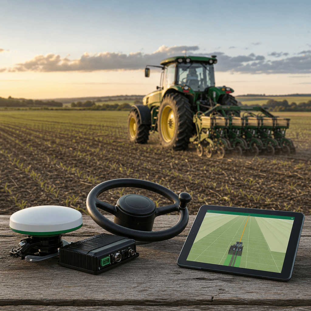
Guidance System For Tractors: Guidance Systems for Tractors: What They Are and How They Cut Your Costs
A guidance system for tractors is the combination of GNSS positioning and automated steering control that keeps a machine on precise, repeatable lines across a field. Paired with RTK correction, it moves accuracy from metre-level to centimetre-level and cuts overlap, fuel, labour hours, and operator fatigue. That accuracy is where the cost savings come from.
We build Agro Navigator around exactly this idea: RTK GPS autosteer delivered through hardware you install once and a native iOS app that runs on the iPad or iPhone already in your cab. This explainer covers what a guidance system actually is, how the pieces fit together, the variants that matter, and the judgement calls that decide whether one belongs on your farm.
Table of contents
- What a guidance system for tractors actually is
- The variants that change your decision
- Where the cost savings actually come from
- Common misconceptions worth clearing up
- What to weigh before you commit
- Frequently asked questions
What a guidance system for tractors actually is
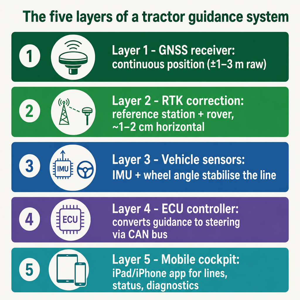
Strip away the marketing and a guidance system is a stack of cooperating layers, each doing one job. Understanding those layers is the fastest way to judge any product, including ours.
At the base sits a GNSS receiver that reads signals from satellite constellations and reports a continuous position. On its own, that position drifts in the ±1–3 metre range — fine for a road, useless for planting rows. A correction source is what tightens it. RTK, the most common high-precision method, uses a fixed reference station and a rover receiver to compute real-time corrections, pulling accuracy into roughly the 1–2 cm horizontal band with pass-to-pass repeatability commonly within about 2.5 cm under good conditions.
Satellite geometry decides how well that math holds up. Dilution of Precision (DOP) describes how the arrangement of satellites in the sky amplifies or dampens position error; the International Association of Marine Aids to Navigation and Lighthouse Authorities defines it as the factor by which GNSS accuracy is degraded by constellation geometry. Wider satellite spacing generally yields lower DOP and a sharper fix. This is why the same hardware can steer beautifully one hour and hunt for a line the next.
On top of positioning sit the working parts: vehicle sensors such as an IMU and wheel-angle input that stabilise guidance when signals degrade, an ECU that translates guidance commands into steering actions, and a human-machine interface for managing lines and reading status.
Our stack maps cleanly onto that model. The iPad or iPhone is the cockpit — field navigation, setup, diagnostics, RTK status, and autosteer control — but it is deliberately not the steering controller and not the RTK receiver. A separate multi-band GNSS receiver supplies the position the app consumes. An Agro Navigator ECU carries machine data over a CAN bus integration into steer-ready tractors and drives the steering hardware. We cover this device-to-steering path in more depth in our RTK GPS autosteer for iPad explainer.
The variants that change your decision
"Guidance system" covers a wide spread of capability, and three distinctions matter more than any brand name.
Visual guidance versus full autosteer. The lightweight end is a lightbar or on-screen bar that shows the operator how far off-line they are and leaves them to steer. Full autosteer takes the wheel through the ECU and steering interface, holding the line without constant correction. The gap between them is not just comfort — automated steering removes the human variability that produces overlap and skips, and that difference shows up directly in fuel and input figures.
Basic GPS versus RTK GNSS. Standard GNSS is adequate for coarse tasks but cannot hold row spacing across repeated passes. RTK is what delivers centimetre-level repeatability — the same line, season after season — which is where reduced skips, fewer double passes, and precise row tracking come from. Autosteer without a proper correction source simply falls back to ordinary GNSS accuracy, and the promised savings evaporate.
Mobile-first open platforms versus PC-based or proprietary terminals. Traditional setups run guidance software on an in-cab Windows laptop or a closed console tied to that brand's hardware and subscriptions. We take a different route: Agro Navigator is positioned as the first AgOpenGPS-compatible system with a dedicated native iOS app, built to work with existing community boards and RTK receivers so operators reuse hardware instead of replacing everything. The app becomes the display; there is no laptop in the cab.
One further split lives inside our own hardware. The base wired model connects the iPad or iPhone to the ECU via Ethernet-over-USB and delivers guidance and autosteer with no cellular modem in the stack. The advanced configuration adds a built-in 4G/GSM modem for live telemetry, remote machine monitoring, and fleet management through an online dashboard. Steering behaves identically on both — the modem changes what you can see about the fleet, not how straight the tractor drives.
Where the cost savings actually come from
The headline in the title — cutting your costs — is not marketing. The savings are mechanical and measurable, and they come from removing waste rather than working the machine harder.
A university study on GPS guidance and autosteer found that automated steering reduced total work time by about 9.7%, driven largely by a 21% reduction in overlap and unnecessary movements, translating into roughly 20% fuel savings and lower CO₂ emissions per hectare. Overlap is the quiet cost: every strip driven twice is double seed, double chemical, double diesel, and double hours. Autosteer collapses that error because the machine, not fatigue, holds the line.
Field trials referenced by Japan's National Agriculture and Food Research Organization reported auto-steer systems reducing labour hours by about 9% while raising yield per hectare by around 9%, so the gain arrives on both sides of the ledger — lower cost and higher output from the same ground.
There is a soil-health argument too. Because guidance standardises traffic patterns, wheels run the same lines instead of wandering, which concentrates and reduces localised compaction — a meaningful factor for small- and medium-scale farms managing long-term soil condition.
This is the outcome our RTK-grade, iOS-centric stack is aimed at. By reusing the tablet in your cab and open AgOpenGPS hardware, we target the same overlap, fuel, and labour savings with less device friction than a proprietary console. For readers weighing that value against outlay, our piece on affordable RTK autosteer for tractors works through the decision without the premium price framing.
Common misconceptions worth clearing up
Three assumptions trip up buyers repeatedly, and each one distorts what to buy.
The iPad provides the accuracy. It does not. The consumer GPS inside a phone or tablet cannot deliver autosteer-grade precision. In our system the device is only the interface; a dedicated external multi-band RTK receiver and a correction source supply the position. Judge the receiver and corrections, not the tablet.
The second is the belief that a cellular modem improves steering. It does not touch accuracy. Our 4G/GSM modem exists solely for telemetry and the fleet dashboard, and it can be omitted or run without a SIM. Steering is identical with or without it.
The third is treating autosteer as mere comfort on top of guidance. The research says otherwise: fully automated steering cuts overlap and stray movement well beyond what a manually followed GPS line achieves, and that reduction is precisely what converts into fuel, input, and time savings. The comfort is real, but it is a side effect of eliminating error, not the point.
Accuracy itself is also conditional rather than guaranteed. Those centimetre figures assume favourable satellite geometry and a solid correction link — the DOP relationship again. Our explainer on GPS dilution of precision unpacks why the same kit performs differently as the sky changes.
What to weigh before you commit
Rather than a ranking, treat these as the criteria that decide fit for your operation.
Tractor and steering compatibility. Our approach leans on CAN bus integration for steer-ready machines, so the practical question is whether your tractor supports that path or needs a hydraulic interface or a correctly installed retrofit motor. Fitment has to be verified for the specific machine — this is not a universal plug-in, and confirming your model up front avoids the most common disappointment.
GNSS receiver and RTK access. The system assumes you can reach a multi-band RTK receiver and a correction source, whether a base station or an RTK network. Without that, autosteer accuracy drops to ordinary GNSS levels and the economic case weakens. Knowing what corrections you can get in your area is a prerequisite, not an afterthought.
Cab hardware preference. If you already run an iPad or iPhone and would rather not add a Windows laptop or a single-purpose console, a mobile-first architecture removes a device from the cab. If your workflow is built around an existing PC-based setup, that preference pulls the other way.
Single machine versus fleet visibility. Decide honestly whether you need guidance on one tractor or live telemetry, remote monitoring, and a dashboard across several. That single distinction is what separates our base wired model from the 4G/GSM configuration, and it is a features decision, not an accuracy one.
Open platform reuse. If you already own AgOpenGPS-compatible boards or community RTK hardware, an open, compatible system lets you keep and extend that investment instead of scrapping it for a closed ecosystem.
Worth noting on scope: our apps and hardware stack are in field-ready development and offered through early-access evaluation rather than as a public app-store download. That makes an early conversation about your tractor, receiver, and corrections the sensible next move. Tell us your machine model, your steering readiness, and what RTK access you have, and we can tell you exactly how the stack maps onto your setup — and point you to the step-by-step how-to once fit is confirmed.
Agro Navigator
Weighing RTK autosteer for your operation?
See how RTK-grade guidance fits a real farm budget when you reuse the iPad in your cab and existing open hardware.
Read the affordable RTK guideFrequently asked questions
What is a guidance system for tractors?
It is a GNSS positioning and automated steering stack that keeps a tractor on precise, repeatable lines. With RTK correction it reaches centimetre-level accuracy, cutting overlap, fuel, and labour.
Do I need RTK, or is basic GPS enough?
Basic GPS suits coarse work but cannot hold consistent row spacing. RTK delivers the centimetre-level repeatability that reduces skips, double passes, and input waste — the source of most cost savings.
Does the iPad or iPhone provide the RTK accuracy?
No. The device is only the operator interface for lines, status, and diagnostics. Accuracy comes from a separate external multi-band RTK receiver and a correction source, not the tablet's built-in GPS.
Does the 4G/GSM modem make steering more accurate?
No. The cellular modem only enables telemetry, remote monitoring, and the fleet dashboard. Autosteer performs identically on the base wired model, and the modem can be omitted or run without a SIM.
Will it work with my tractor?
Our system uses CAN bus integration for steer-ready tractors, with hydraulic or retrofit-motor options in other cases. Fitment must be verified per machine, so share your tractor model and we can confirm compatibility.