Back to blog
21 min read
GPS Dilution of Precision Explained: Why It Matters for Autosteer Accuracy

GPS Dilution of Precision Explained: Why It Matters for Autosteer Accuracy

You have RTK GPS on the roof, a steer-ready tractor wired through the CAN bus, and a box that promised centimeter accuracy. Yet on certain passes the AB line drifts, the guidance softens as you swing past the tree line, and one headland always seems to need a second run. Most operators blame the receiver, the base station, or the correction signal. The real culprit is usually satellite geometry, measured as gps dilution of precision (DOP) — a unitless multiplier that decides how much raw ranging error reaches your steering wheel before you ever feel it. DOP does not add error to your position. It multiplies error that is already there. That distinction is the difference between a straight, repeatable line and a headland you redrive. By the end of this piece you will read live DOP on your display, know the threshold at which to pause a precision pass, and understand exactly what your hardware can and cannot do about the sky above the cab.

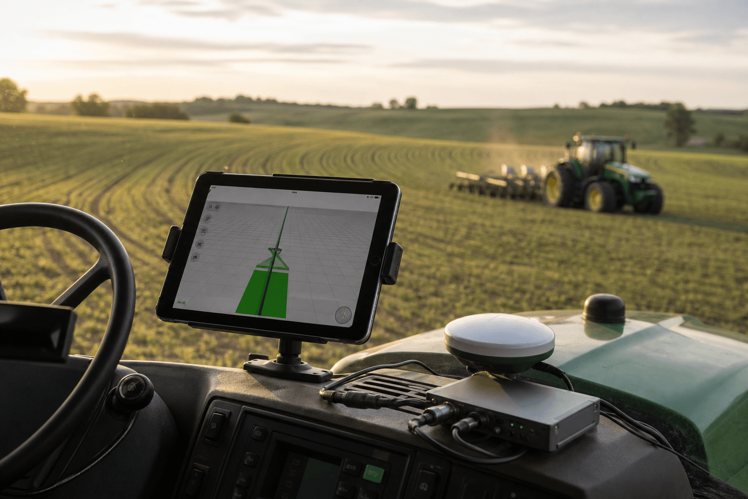
A modern tractor mid-field driving a straight parallel pass at golden hour, GPS antenna visible on the cab roof, an open sky above with a distant tree line on one edge — composed to hint at both clear sky and a partial obstruction.

Table of Contents

What Dilution of Precision Actually Measures (and What It Doesn't)

GPS dilution of precision is a dimensionless factor — a pure multiplier with no units of its own — that describes how satellite geometry amplifies or suppresses the ranging error your receiver is already carrying. It is not an error value. It is the gain knob applied to error. Hold this relationship in your head and most of the confusion around autosteer accuracy dissolves:

Position error = ranging error × DOP

That formula is the entire concept. Your receiver measures the distance to each satellite with some inherent uncertainty, often expressed as User Equivalent Range Error (UERE). DOP takes that number and scales it up or down depending on where the satellites sit in the sky. Multiply a small ranging error by a small DOP and you get a tight, repeatable position. Multiply the same ranging error by a large DOP and the position smears out, even though nothing about the receiver or the signal changed.

The standards-grade example makes the stakes obvious. According to the Noomio GNSS threshold FAQ, a system with a nominal 6 m ranging accuracy operating at a DOP of 50 could see position errors balloon to roughly 300 m. Same satellites. Same measurements. Same receiver. Geometry alone wrecked the solution by a factor of fifty. No agricultural operation runs at DOP 50, but the arithmetic scales all the way down to the values you actually see in the field, which is precisely why it matters.

Here is the spatial model that explains it. When the visible satellites are spread widely across the sky dome, their range measurements intersect at sharp, well-defined angles. Sharp angles produce a small, tight error region on the ground — low DOP. When the satellites cluster together in one patch of sky, those same range lines cross at shallow angles, and shallow intersections smear the position solution into a large, uncertain region — high DOP. Alfred Leick, PhD, geodesist and co-author of GPS Satellite Surveying, defines DOP explicitly as a ratio between position error and range error. Treat it as a multiplier on measurement noise. Never mistake it for the noise itself.

Three things get routinely conflated with DOP, and each one is a separate variable:

  • Signal quality / signal-to-noise ratio. This is how strong each individual satellite signal is. A strong signal can still sit in terrible geometry, and a weak signal can sit in excellent geometry. Different axis entirely.
  • RTK fix status. This reports whether your correction stream has resolved to a fixed solution. You can hold a rock-solid fixed RTK solution and still carry poor geometry that widens your position error. The fix and the geometry are independent links in the chain.
  • Receiver accuracy specs. That marketed 1–2.5 cm figure is a best-case-geometry number. It is what the hardware achieves when DOP is low and multipath is controlled — not a guarantee that follows the machine into every field.

There is a counter-point worth internalizing before you trust any single number. DOP describes geometry and nothing else. It does not account for multipath, atmospheric delay, or receiver-quality problems. That means a low HDOP near a metal grain bin or a reflective steel shed can hand you a false sense of security: the geometry reads clean while reflected signals quietly degrade the solution. GISGeography and the Penn State GEOG 862 course notes both stress this limit. Geometry is necessary. It is not sufficient.

Infographic: Good Geometry vs. Poor Geometry

DOP does not add error to your position — it multiplies the error already there, which is why perfect hardware still wanders under a bad sky.

The DOP Family: GDOP, PDOP, HDOP, VDOP, and TDOP

DOP is not one number. It is a family of related values, each isolating a different dimension of uncertainty. Because you steer in the horizontal plane, HDOP and PDOP carry the most weight for row guidance — the rest are diagnostic context or belong to other jobs entirely.

DOP Type What It Isolates Relevance to Autosteer
GDOP Overall geometric quality (3D position + clock) Diagnostic summary
PDOP 3D position (lat, lon, height) High — overall steering confidence
HDOP Horizontal position (lat, lon only) Highest — controls left/right accuracy
VDOP Vertical position (height) Low for steering; matters for terrain
TDOP Receiver clock/time Indirect; usually inside GDOP

GDOP — geometric dilution of precision — expresses the overall effect of satellite geometry across every solution parameter at once, including three-dimensional position and receiver clock time. It is the broad "how good is this whole fix" summary. Useful as a headline, too coarse to steer by.

PDOP — positional dilution of precision — strips out the clock term and isolates three-dimensional positional uncertainty: latitude, longitude, and height combined. Most receivers surface PDOP as the primary geometry indicator on the display, which makes it the number you will encounter most often. It is your overall steering-confidence check.

HDOP — horizontal dilution of precision — is the one that matters most for guidance. It measures geometry-driven uncertainty in latitude and longitude only, which is exactly the left–right error an autosteer operator feels through the wheel. Phil Wernette, a geospatial educator featured in GNSS training material, frames HDOP as the component practitioners feel most directly as left–right accuracy. When your AB line wanders side to side, HDOP is the value that predicted it.

VDOP — vertical dilution of precision — captures height uncertainty and tends to run significantly larger than HDOP for most constellations. That sounds alarming until you remember you are not steering in the vertical axis. VDOP matters for elevation mapping, drainage planning, and terrain models. For pure row guidance you can largely set it aside.

TDOP — time dilution of precision — relates geometry to receiver clock uncertainty. It affects how reliably the system synchronizes its measurements, but it is usually folded into GDOP rather than displayed on its own. Most operators never see it as a standalone value and do not need to.

So what do you actually watch? For guidance, HDOP is the single value to keep in front of you — it is the direct proxy for expected left–right accuracy, the error you will physically drive over. PDOP is the useful secondary check, confirming the overall three-dimensional solution is sound rather than propped up by good horizontal geometry hiding a weak vertical one. You can safely ignore VDOP while steering, but the moment the job becomes elevation mapping or terrain modeling, VDOP moves to the front of the queue and HDOP takes a back seat. The right number to monitor depends on the task, and for planting, spraying, and tillage that number is HDOP first, PDOP second.

Reading DOP Values — What's Good, What's Marginal, What's Unworkable

A raw DOP number means nothing until it drives a decision. The survey-grade classification gives you a starting scale, drawn from the Noomio GNSS threshold reference: DOP below 1 is ideal, 1–2 excellent, 2–5 good, 5–10 moderate, 10–20 fair, and above 20 poor.

DOP Value Rating Action for Field Work
< 1 Ideal Full-confidence autosteer
1–2 Excellent Normal precision operations
2–5 Good Acceptable; verify row-to-row repeatability
5–10 Moderate Caution — check line consistency
10–20 Fair Delay precision-critical passes
> 20 Poor Do not rely on autosteer

That scale was built for general survey work, and precision guidance demands more. GNSS.ae recommends PDOP in the 1–3 range and HDOP below about 1.5 for high-confidence positioning — tighter than the generic "good" band because guidance work leaves less room to hide error. In practical terms: DOP under 2 is excellent and fit for high-precision passes; 2–5 is good but warrants caution when you need strict row-to-row repeatability; anything above 10 should trigger postponement of a precision-critical pass rather than a shrug.

Now the nuance that separates a working operator from a spec sheet. Public glossaries hand out blunt cutoffs — Discovery Engineering, for instance, classifies PDOP below 4 as "good" geometry and above 7 as "weak." Those numbers are fine for turn-by-turn navigation. They are marginal for centimeter autosteer. Acceptable DOP is not a universal constant; it depends on the underlying device accuracy and the task in front of you. A DOP value that keeps a delivery van on the correct street can still leave a planter drifting off its intended row. That is why the table above is a starting reference, not a law.

The operation itself sets the real threshold. A planting pass tolerates far less geometric slack than a tillage pass, because seed spacing and pass-to-pass repeatability drive emergence and yield in ways a tillage tool simply does not care about. Match your cutoff to the job, not to a single memorized figure.

And keep the two links separate in your head. A great RTK fix layered over poor geometry will still wander. The fix tells you the correction resolved; the geometry tells you how much your remaining error gets multiplied. Both have to be good at the same time.

A perfect RTK fix over bad satellite geometry is a fast route to a crooked line — accuracy is a chain, and DOP is the link most operators never inspect.

What Makes DOP Get Worse in the Field

DOP is not random. It degrades for specific, identifiable reasons, and every one of them shows up in ordinary field work.

Sky obstructions. Tree lines, buildings, silos, and hills block part of the constellation. When a stand of timber removes every satellite low on your western horizon, the solution is forced onto a narrower, more clustered set of remaining satellites — geometry tightens into a bad angle and DOP climbs. Worse, those same structures invite multipath, where signals bounce off surfaces before reaching the antenna. DOP does not capture multipath at all, so an obstructed boundary hits you with two problems while your geometry reading only warns about one.

Time of day and satellite orbits. Satellites move, and geometry shifts predictably as they travel their orbits. The identical field can offer clean geometry mid-morning and weak geometry an hour later, purely because the constellation rearranged overhead. The Penn State GEOG 862 notes and standard DOP lecture material both underline this orbital predictability — and predictability is your friend. A window that wanders today will wander at the same time tomorrow, which means you can schedule around it.

Constellation count. A GPS-only receiver sees a fraction of the satellites a multi-constellation unit does. Add GLONASS, Galileo, and BeiDou and you dramatically increase the number of visible satellites, which spreads geometry across more of the sky and lowers PDOP and HDOP through more of the day. More satellites, more spread, tighter lines. This is the single most reliable hardware lever you have against poor geometry.

Elevation mask settings. The elevation mask cuts off satellites below a set angle above the horizon. Raising it removes low-angle satellites that carry the most atmospheric noise — a genuine benefit — but it also reduces your total satellite count, which can tighten geometry or worsen it depending on where the remaining satellites sit. It is a balance to tune, not a free win to crank up.

Terrain and slope. Working the floor of a valley or the face of a steep hillside physically limits the visible sky dome. The ground itself blocks a slice of the constellation regardless of how good your receiver is. Fields cut into slopes or terraced hillsides restrict geometry by their shape alone, which is worth planning around when you lay out passes on terraced or valley ground.

A tractor working a field boundary directly beside a mature, tall tree line, shot from a low angle showing how the canopy cuts into the open sky above the machine — a literal sky-obstruction scenario.

How DOP Translates into Steering Error You Can See in the Cab

Abstract multipliers do not damage crops. Lateral error does. So walk the arithmetic from geometry to the physical consequences you drive over: skips, overlaps, wandering AB lines, misaligned headlands, and uneven seed spacing.

HDOP is described in technical glossaries as a real-time indicator that multiplies User Equivalent Range Error (UERE) to produce horizontal uncertainty. That is the whole mechanism, and it is simple enough to run in your head. Take a receiver with a 2 cm ranging error. Operate it under an HDOP of 6 and your lateral steering error works out to roughly 12 cm — enough to matter badly in row crops planted on tight spacing, enough to overlap or skip in ways you will see at emergence. Now take the identical receiver with the identical 2 cm ranging error and put it under an HDOP of 1.2. Lateral error drops to about 2.4 cm, comfortably inside tolerance for most operations. Same hardware. Same signal quality. Same everything except the sky — and the result differs by a factor of roughly five.

That factor is the entire point. The receiver did not get better or worse between those two cases. The geometry did. This is why two operators running identical equipment can report wildly different real-world accuracy, and why the same machine feels precise in an open quarter-section and sloppy along a wooded boundary.

Infographic: Same Ranging Error, Two Skies

The tolerance you can accept depends heavily on the operation, and the three most common field jobs sit at three different points on that scale.

Planting is the least forgiving. Row-to-row and pass-to-pass repeatability drive emergence, spacing, and ultimately yield. A 12 cm lateral wander that a tillage tool would shrug off can put seed into the previous pass's row or leave a gap wide enough to cost you plants per acre. Planting is where you hold the tightest DOP threshold.

Spraying sits in the middle. Boom section overlap and gap tolerance is wider than seed spacing, so moderate geometry error is more survivable — but every centimeter of drift wastes chemical through overlap or leaves an untreated strip. The cost is economic and environmental rather than agronomic, but it is real.

Tillage is the most forgiving of the three. The tool works a wider band, the consequences of a few centimeters of drift are minor, and you can run through geometry that would force you to pause a planter.

Here is the honest gap between marketing and field reality. GNSS equipment suppliers such as ArduSimple and CHCNAV advertise RTK precision-agriculture systems in the 1–2.5 cm range, and that figure is achievable — but only when DOP is low and multipath and obstructions are controlled. According to the GISGeography GNSS accuracy explainer, that centimeter-level performance holds solely under favorable geometry with reflective structures kept out of the picture. The spec is a ceiling reached under good conditions, not a floor guaranteed under all of them.

Centimeter hardware does not guarantee centimeter results — the sky above your tractor gets a vote.

Managing and Minimizing DOP with Your Hardware and App

Geometry is not fully under your control — you cannot move satellites — but you have more levers than most operators use. Each of the following comes with the reason it works, because a step you understand is a step you will actually run.

  1. Run a multi-constellation RTK receiver. GPS alone sees a limited slice of the sky. Adding GLONASS, Galileo, and BeiDou raises your visible satellite count, spreads geometry wider across the dome, and lowers PDOP and HDOP through more of the day. This is the highest-leverage hardware choice you can make against poor DOP, because it attacks the root cause: too few satellites in too small a patch of sky.
  2. Mount the antenna for the clearest sky view. The center of the cab roof, clear of metal masts, beacons, and work lights, gives the antenna an unobstructed dome. Every fixture that shadows the antenna removes satellites from one region of sky and tightens your geometry the wrong way. A poorly placed antenna manufactures its own high DOP before you leave the yard.
  3. Monitor live HDOP and PDOP before committing to a precision pass. HDOP is your in-cab proxy for expected left–right accuracy, and PDOP confirms the overall solution is sound. Reading them takes seconds and turns a guess into a decision. The Agro Navigator native iOS app surfaces this satellite and DOP status directly on the iPad or iPhone, with no Windows PC in the chain — the readout lives on the same screen as the AB line you are about to drive.
  4. Time obstruction-prone fields for better geometry windows. Because geometry is orbit-driven and predictable, a field that wanders at 8 a.m. beside a tree line may hold cleanly by mid-morning as the constellation shifts. Scheduling the tightest passes for the strongest geometry window costs nothing and can be the difference between a clean planting and a redriven one.
  5. Tune the elevation mask sensibly. Cutting low-angle satellites removes the noisiest signals, but pushing the mask too high strips your total count and can worsen geometry. Set it to trim atmospheric noise while preserving enough satellites for good spread — a balance you dial in per environment, not a single global setting.
  6. Log and review telemetry to catch recurring DOP problems. A one-off wander is annoying; a pattern is actionable. The advanced configuration with the built-in 4G/GSM modem streams live telemetry to an online dashboard, letting a fleet manager see which fields and which time windows repeatedly produce weak geometry. That turns "the line just wanders sometimes near the north boundary" into a scheduled, known constraint you plan passes around.
An iPad mounted in a tractor cab running the guidance app, screen showing the AB line and a visible satellite/DOP status readout, operator's hand near the wheel, field visible through the windshield.

DOP, Standards, and the Limits of a Single Number

Geometry can be measured, tuned, and monitored — but it is not the only thing standing between marketed accuracy and field results, and there is a formal way to hold vendors to their claims.

ISO 12188 defines test procedures for satellite-based positioning and guidance systems used on agricultural and forestry tractors and machinery. Its purpose is to make accuracy and repeatability figures comparable across different devices, so that claimed centimeter-level performance can be verified under standardized field tests rather than taken on faith from a datasheet. According to the International Organization for Standardization, the framework exists precisely to close the gap between a marketed number and a measured one. ISO 12188-2 goes further, focusing on dynamic testing — assessing how a guidance system performs while the tractor is actually moving, not just parked in static or laboratory conditions. That dynamic focus matters, because geometry, multipath, and machine motion all interact in the field in ways a static bench test never reveals. The Eurolab summary of the standard frames it the same way.

Then there is the boundary of what DOP itself can tell you. DOP describes geometry and only geometry. It ignores multipath, ionospheric and atmospheric delay, and receiver-quality issues — all of which can degrade a solution while your DOP reading looks perfectly healthy. GISGeography and the Penn State GEOG 862 notes both make this explicit. A low HDOP near a steel structure is not a clean bill of health; it is one green light among several you need to check.

The expert framing lands the same conclusion from two directions. Bradford W. Parkinson, PhD, the chief architect of GPS, has stressed that geometry is as critical to user accuracy as the satellites themselves, because poor geometry makes otherwise precise measurements misleading on the ground. Paul D. Groves, PhD, Professor of Navigation at University College London and author of a standard text on integrated navigation systems, puts the boundary sharply: low DOP is a prerequisite for true centimeter-level performance, not a guarantee of it. Both statements point at the same discipline. Treat DOP as one link in the accuracy chain — necessary, monitorable, worth checking before every precision pass — but never sufficient on its own. Verified guidance accuracy is what lets precise seed and input placement actually support the yield outcomes you planned the season around.

Common Questions About GPS Dilution of Precision and Autosteer

Is a low DOP the same as a good RTK fix?

No. RTK fix status reports whether your correction stream has resolved to a fixed solution; DOP reports satellite geometry. They are independent variables. You can hold a fixed RTK solution and still carry weak geometry that widens your position error, and you can have strong geometry while your correction stream drops to float. Both have to be good at the same time for a tight, repeatable line. Checking one while ignoring the other is how a well-equipped machine still wanders.

What DOP value should I stop autosteering at?

Use the decision matrix as a starting reference rather than a hard law. A DOP above 10 warrants postponing precision-critical passes, and values in the 2–5 band call for caution when you need strict row-to-row repeatability. Planting demands tighter geometry than tillage, so match the threshold to the operation in front of you rather than to a single universal number. The right cutoff for a planter is stricter than the right cutoff for a disk.

Does adding GLONASS, Galileo, and BeiDou actually lower DOP?

Yes. More constellations mean more visible satellites, and more satellites spread across more of the sky produce sharper intersection angles and a tighter solution. That lowers both PDOP and HDOP and stabilizes guidance through more hours of the day. A multi-constellation receiver is the most dependable hardware step you can take to keep geometry in a workable range, especially near obstructions that clip part of the sky.

Can I predict when DOP will be bad for a specific field?

Largely, yes. Satellite geometry follows predictable orbital cycles, so an obstruction-heavy field tends to have recurring weak windows at similar times. Telemetry logging on the advanced configuration lets you confirm the pattern per field and per time of day, so a boundary that wanders every morning becomes a scheduled known rather than a repeated surprise. Predictability turns geometry from a frustration into a planning input.

Where do I see DOP in the app?

Live satellite and DOP status appears directly on the iPad or iPhone display, with no Windows PC required in the chain. You can read HDOP and PDOP on the same screen as your AB line before committing to a pass, which makes the pre-pass geometry check a two-second glance rather than a separate step on separate hardware.

Your Pre-Pass DOP Field Check

Run this before any precision-critical operation. It takes under a minute and converts "the line just wanders sometimes" into a measured, defensible decision.

  1. Confirm RTK fix status. Verify a fixed solution — not float — before you look at anything else. A float solution is a stop sign regardless of how clean the geometry reads.
  2. Read live HDOP and PDOP on the app. HDOP is your left–right proxy and the number that predicts the error you will physically drive over; PDOP is your overall three-dimensional confidence check. Glance at both.
  3. Cross-check against the threshold for this operation. Planting demands tighter geometry than spraying, and spraying is tighter than tillage. Pull the matching band from the decision matrix and hold the pass to that standard, not a generic one.
  4. Scan the intended path for sky obstructions. Note the tree lines, buildings, silos, and valley walls that will clip the constellation as you work toward them. The wander usually arrives where the sky narrows.
  5. If marginal, note the time and check telemetry logs. Identify a stronger geometry window for this specific field using the logged history from the advanced 4G configuration. A pass that fails at 8 a.m. may pass cleanly at 10.
  6. Make the proceed or delay call. Commit to the pass or reschedule it with a documented reason. Either outcome is a controlled decision rather than a hope.

You now control a variable most farmers never diagnose: the sky itself. The geometry overhead was always shaping your accuracy — the difference is that you can now read it, predict it, and schedule around it before the first row goes crooked instead of after.